


Lower and Upper White Creek Falls are a worthy destination to an out and back hike or a fun off-trail loop in the Sipsey Wilderness area of Bankhead National Forest.
At a Glance
- 6.5 mi round trip
- Nice View
- Kids OK


Gear: Our favorite snacks and camera gear
Gallery: Check out the pictures here
White Creek Falls – Trip Details
Trailhead / Parking
The parking area at Randolph Trailhead is pretty large on all but the busiest of days, and it’s just off of Cranal Road. So, you shouldn’t have a hard time finding it. There is a map and small shelter at the trailhead for reference.
Of course, that’s no excuse for not having a paper map and compass with you! Your phone and that picture could get dropped in the water, and you always want to have a backup method of navigation for safety. 😉
Trail Conditions
Much of the hike to White Creek Falls is wooded upland in the Sipsey Wilderness Area of Bankhead National Park. In the rainy seasons, you’ll likely hit muddy area of the trail, so be prepared with boots or waterproof shoes in the shoulder seasons.
This trail (the 201 and then the 209 is well-travelled, so you shouldn’t have a hard time with deadfall unless you decide you make a loop after visiting the falls on White Creek.
Once you leave the 209 trail at the Sipsey River, you’ll be across the river from the primary trail on a social trail as you make your way to White Creek. Then, you’ll be following the same up to the falls on White Creek.
If you choose to go beyond the lower falls, the trail will get progressively less-traveled and more difficult. As with most wilderness hikes in Bankhead National Forest, expect some required stream crossings if you choose this option, as you can’t always count on having a flat bank to walk on next to a creek or stream.
The Hike

You’ll start out by following the 201 trail when the 202 splits off to the east. You’ll be hanging a left after several hundred yards, but this one is hard to miss.
There is one upland campsite in this section of the trail that I remember. The other overnight options are along the Sipsey River.
After that, continue about 2 miles to the intersection of the 201 and 209 trails. Following the 209 is shorter, and you’ll hang a right at the Sipsey River. On the way down, there may be a small stream and cascade to navigate depending on recent rainfall.
Once you turn to head east along the southern side of the Sipsey, White Creek will be the first significant tributary that you come to and will be flowing north into the river. Turn and head up the creek here. You’ll likely be staying on the western bank for convenience.
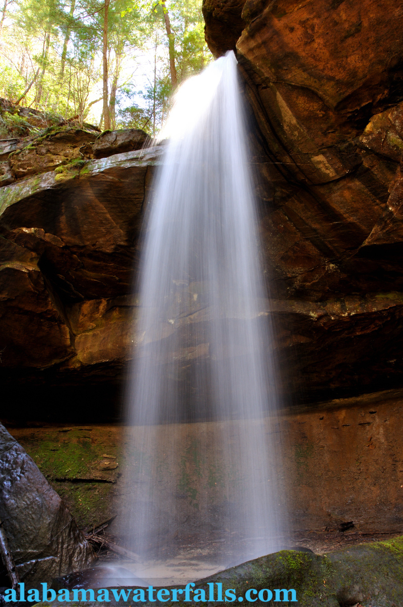
From here, it’s less than half a mile to Lower White Creek Falls. What a beauty!
To see Upper White Creek Falls, most people will opt for the scramble up the western side of the canyon to the top of the Lower Falls. The upper fall is much shorter, but has a nice pool at the base of it.
From here, you can either backtrack down to the river and back out the way you came or continue to follow White Creek until you decide to cut back over to the 201 trail.
All in all, this is a long trip for a day but doable if you’re in average shape, even with young kids if you can carry them to give shorter legs a rest occasionally!
More Waterfalls around Bankhead National Forest
Your trip to White Creek Falls will take most of a day, but you could easily catch a quick stop at Mize Mill Falls or Turkeyfoot Falls. And, if you have more time in the area, it’s absolutely packed with great hikes and waterfalls!
White Creek Falls Map, Directions, and Resources

Directions
Get DirectionsParking
$0, gravel lot at Randolph TrailheadGPS Coordinates
34.312859, -87.467080
Weather – Upcoming Forecast
Don't get lost in the woods!

